One hundred years ago today, the National Park Service was founded. One hundred years ago today, our government began the process to preserve the best wilderness and historically significant locations across the country. It was a step that ensured that every American from that moment forward would have the opportunity to experience the best America has to offer.
I am truly passionate about our national park system. It is America’s best idea. To celebrate, I have been spending the year visiting as many “new” national parks as possible. I took full advantage of a business trip to Las Vegas in June to explore several of Arizona’s national parks. The road trip centered on the Grand Canyon, a crowning jewel of the park system and a world heritage site. While I had visited the Grand Canyon before, I had never explored the national park portion. It seemed only fitting to visit during the centennial celebration!
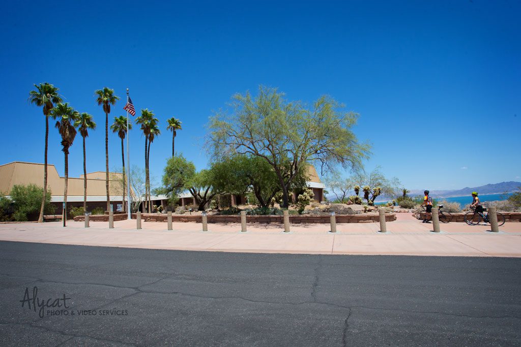
I began my road trip with a stop at Lake Mead National Recreation Area. Anchored by the Hoover Dam, the waters from the Colorado and Virgin Rivers come together to help form the lake at the Nevada/Arizona state line. Lake Mead offers a variety of activities to enjoy: hiking, biking, fishing and boating just to name a few. Tours of the Hoover Dam are available, but only during park hours. The tour also includes a brief security stop with Homeland Security. Since you can no longer drive across the dam, this is really the best and only way to experience it.
If you are up for an adventure, take the time to visit St. Thomas. St. Thomas is a ghost town that has been under water since the construction of the dam. Due to the long standing drought, parts of the town are once again above water. It has incredible history. Be sure to stop by the ranger station to get weather and road conditions before heading up there.
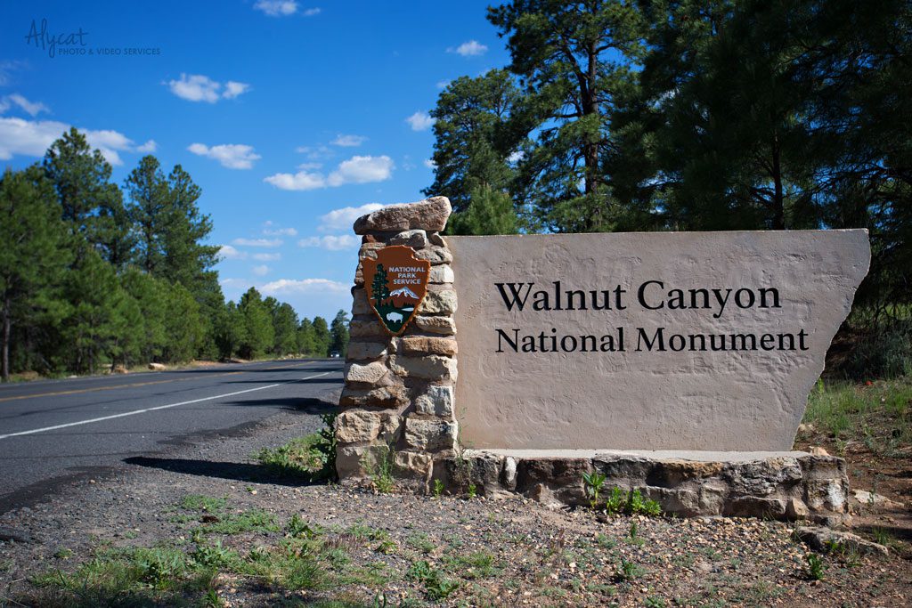
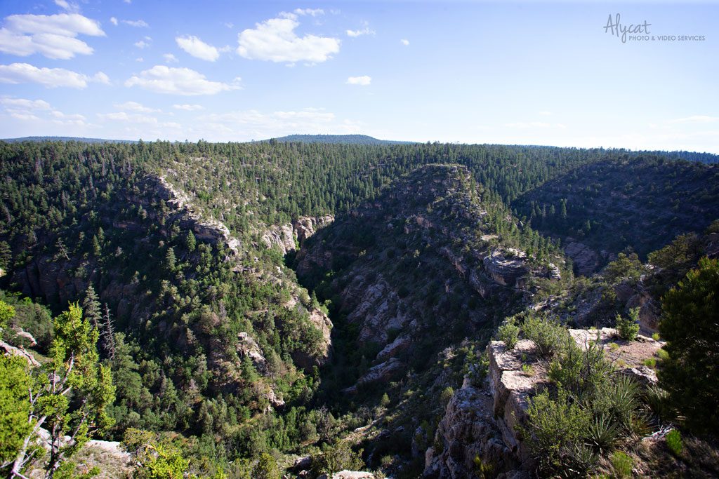
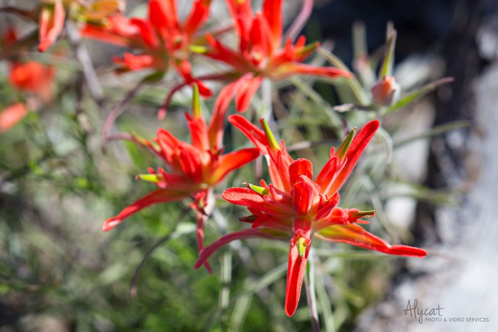
From there, the drive down I-40 took me to Flagstaff, Ariz. I fell in love with this small but vibrant town. It is also a great jumping off point to some incredible national parks. There are six within a two-hour drive. The closest is Walnut Canyon National Monument. Along with stunning views, Walnut Canyon offers a close-up look at cliff dwellings, which were home to the Sinagua people more than 800 years ago. Be sure to get there early though. It takes a little over an hour to complete the round-trip hike to the cliff dwellings. By late afternoon, the trail is closed to visitors so that the park can close on time.
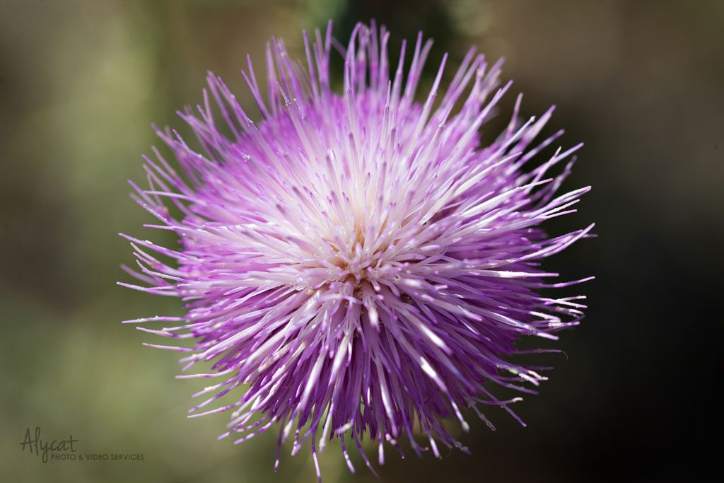
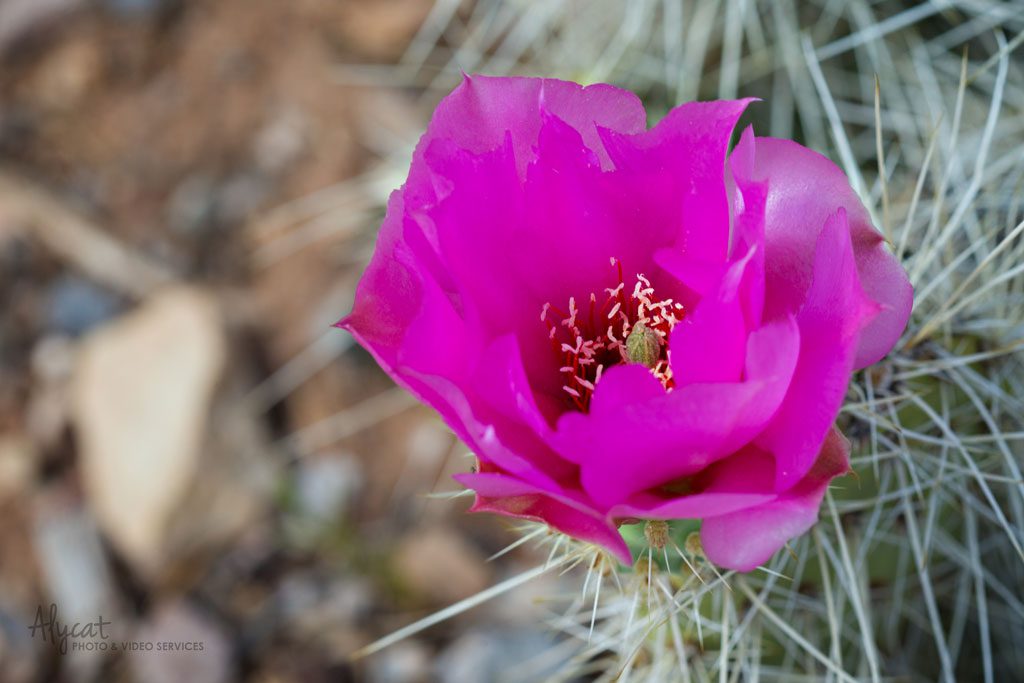
Another thing I absolutely loved about Walnut Canyon was the beautiful colors and variety of the flowers.
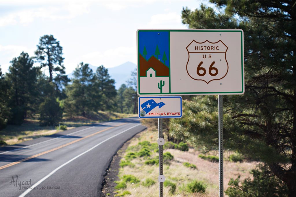
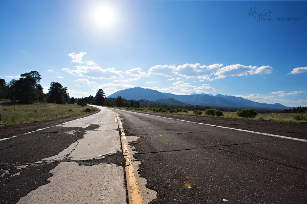
Without planning it, I spent an afternoon enjoying the drive along historic Route 66. I happened upon it after leaving Walnut Canyon. How could I pass up on this opportunity? It was a gorgeous day for a ride!
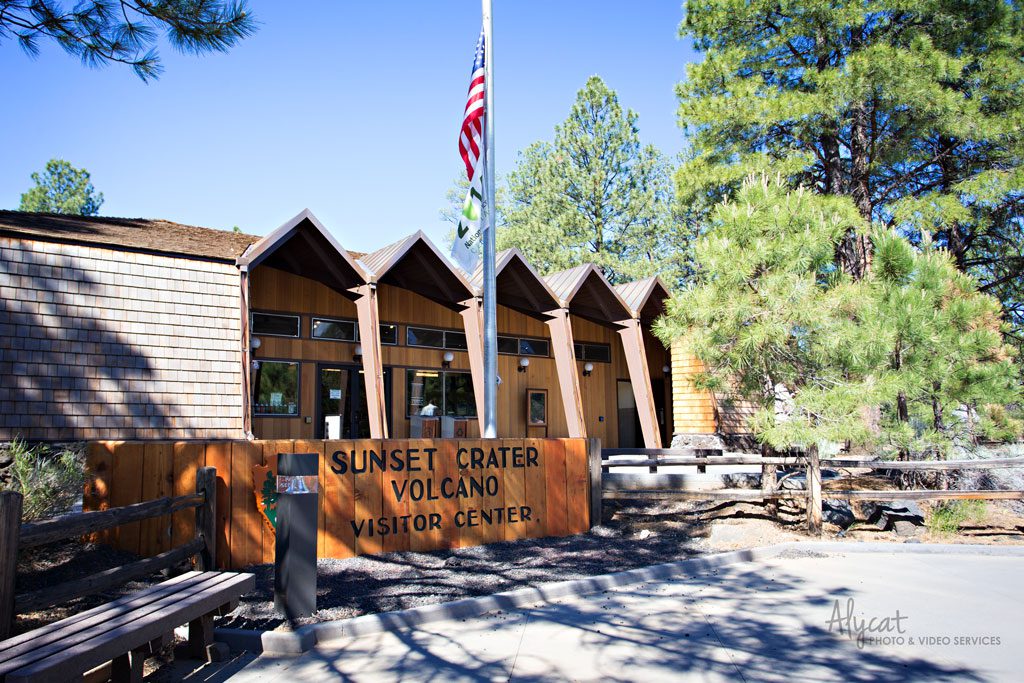
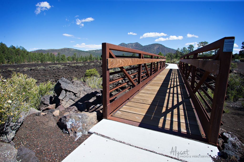
Just north of Flagstaff are Sunset Crater Volcano and Wupatki National Monuments. The two parks both sit just east of Route 89 (one of the main roads to the Grand Canyon). You’ll first come to Sunset Crater Volcano NM. That road is a 35-mile loop that runs through Coconino National Forest and connects the two parks. It is a slow, but beautiful drive. Be sure to plan on spending a good portion or even a whole day exploring these two parks and the area that connects them.
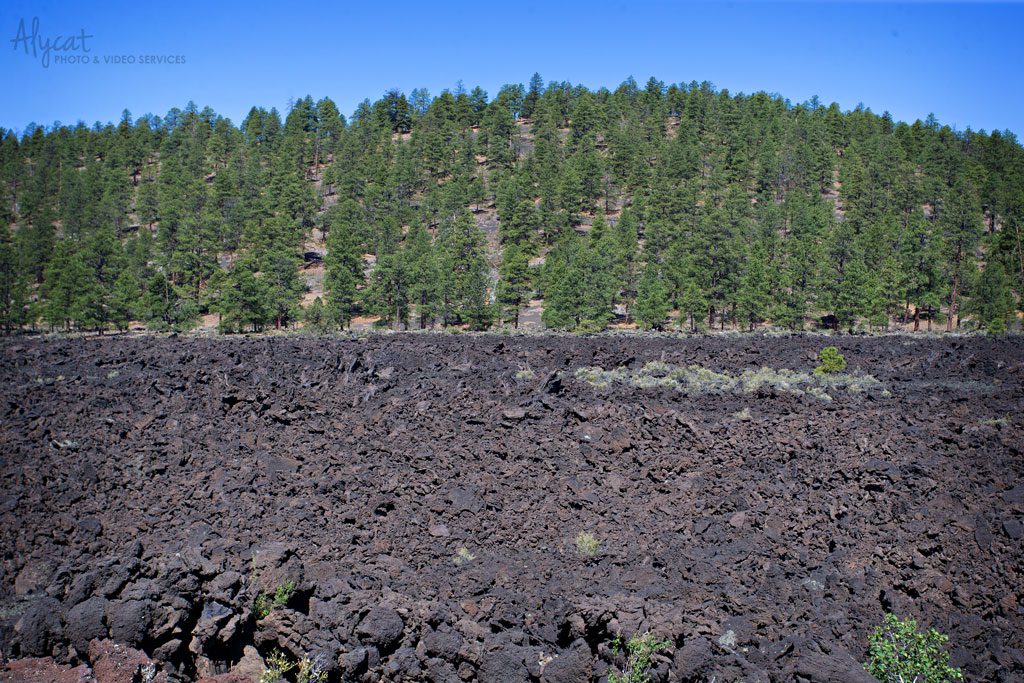
I have to admit, Sunset Crater Volcano was not at all what I was expecting. I felt like I was back in Hawaii, not the middle of Arizona. Sunset Crater Volcano erupted more than 900 years ago and is a symbol of the incredible volcanic activity that has occurred in the Flagstaff area over the last six million years. Who knew Flagstaff had such a history?!
The trail system in the parks offers something for everyone. From paved walkways to rugged trails, you can find something for every hiking level.
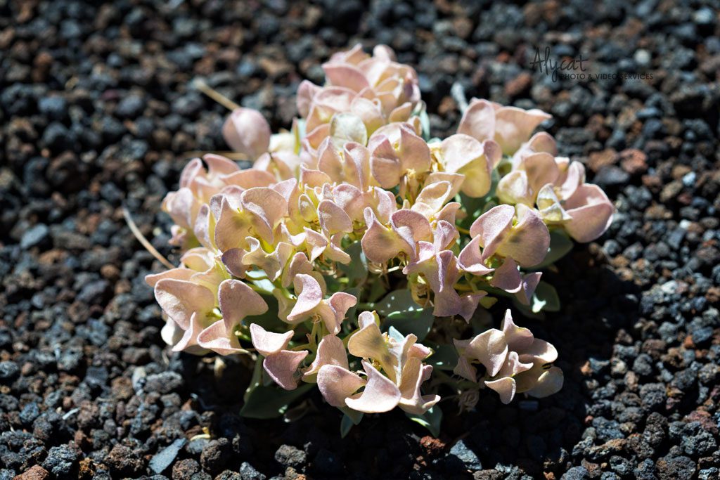
Life out of the rock and ash. Mother Nature is just incredible!
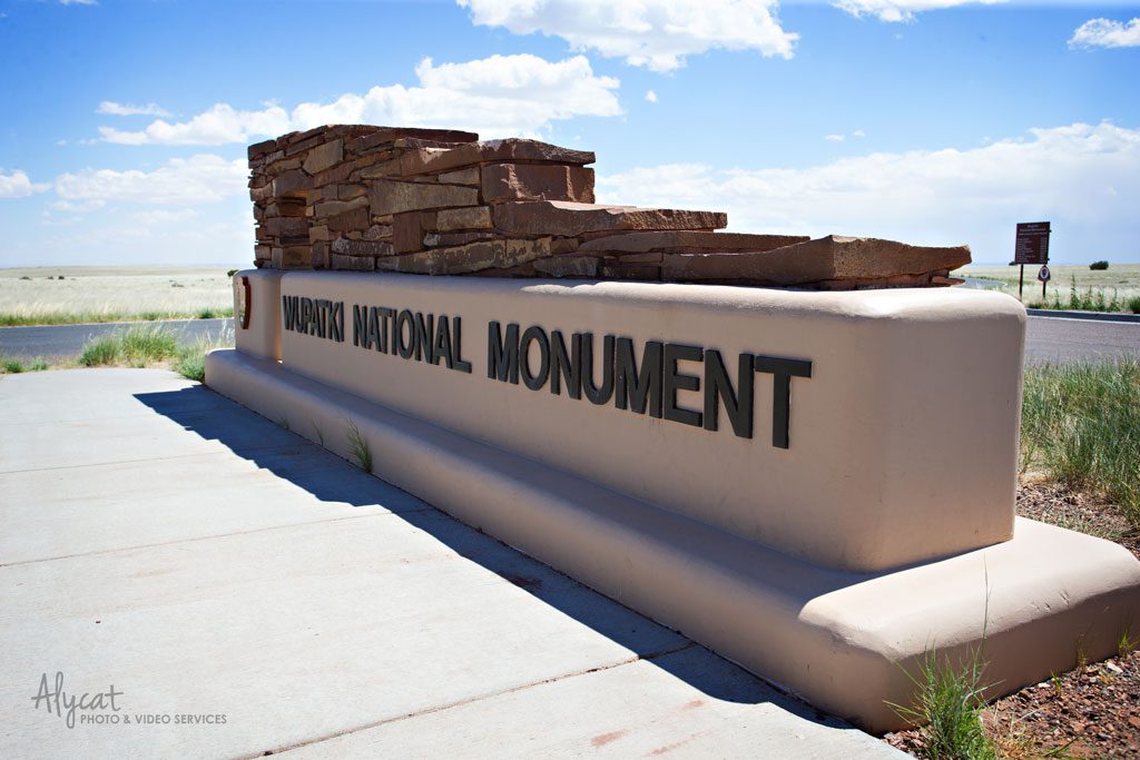 Continue on that 35 mile loop to get to Wupatki National Monument. Trust me, it is so well worth it!
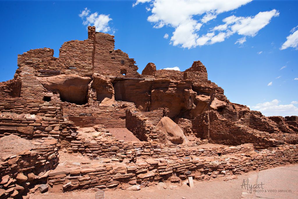
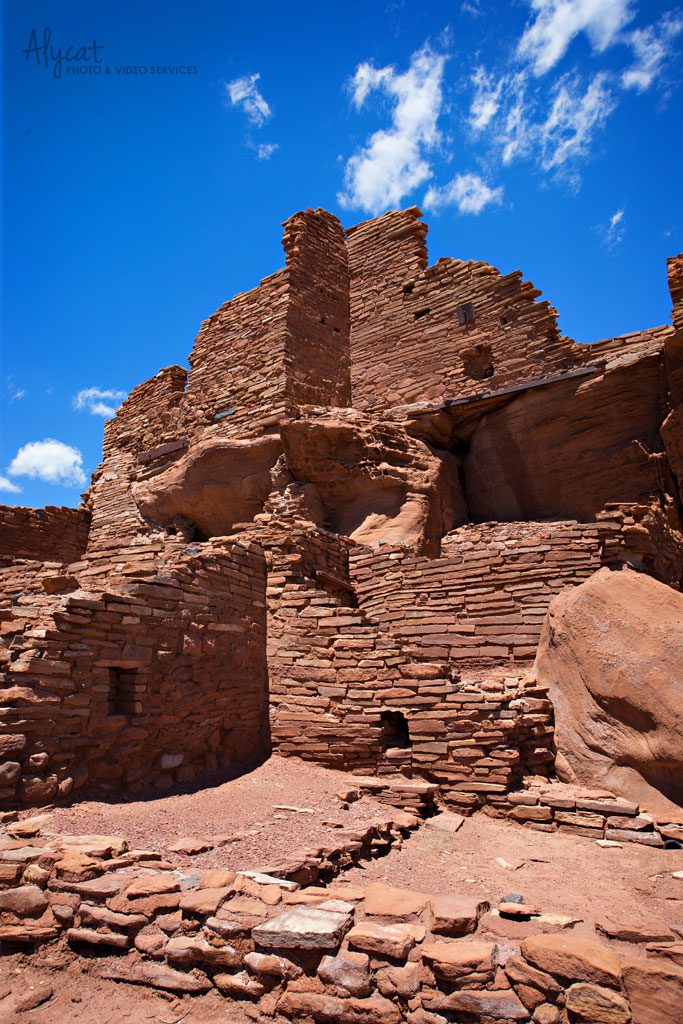
Welcome to Wupatki National Monument! These ruins are the remains of masonry villages built by Puebloan people soon after the eruption of Sunset Crater Volcano. The volcanic eruption made the area of Wupatki viable farm land and drew many from around the Colorado Plateau to the area. These pueblos have stood the test of time for over 800 years.
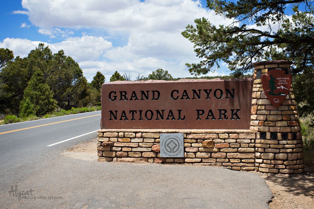
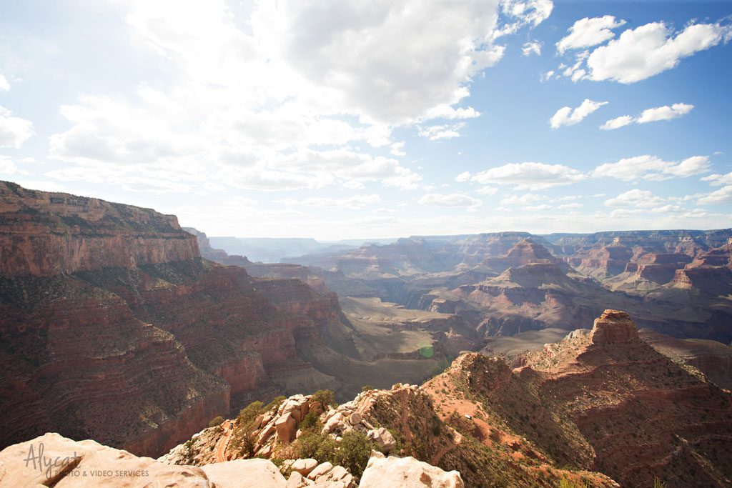
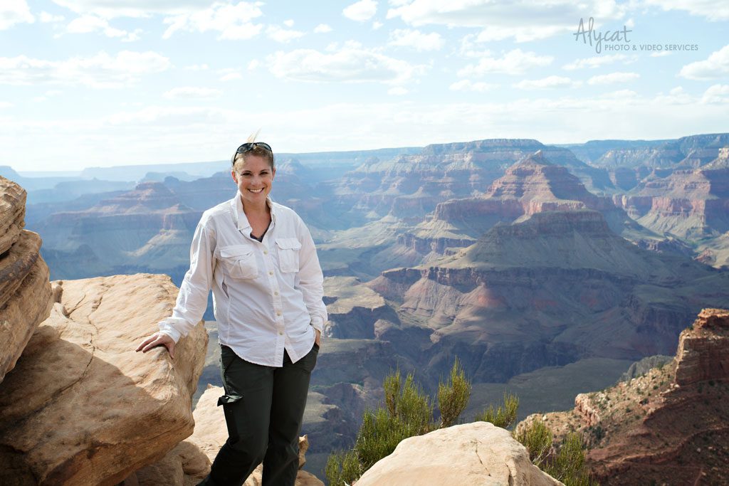
Finally, the Grand Canyon! While I enjoyed my time at the other parks, I was itching to get to day 3 of my trip when I would finally reach the canyon. My goodness, it did not disappoint. My only regret… not getting to spend more than two days at the park.
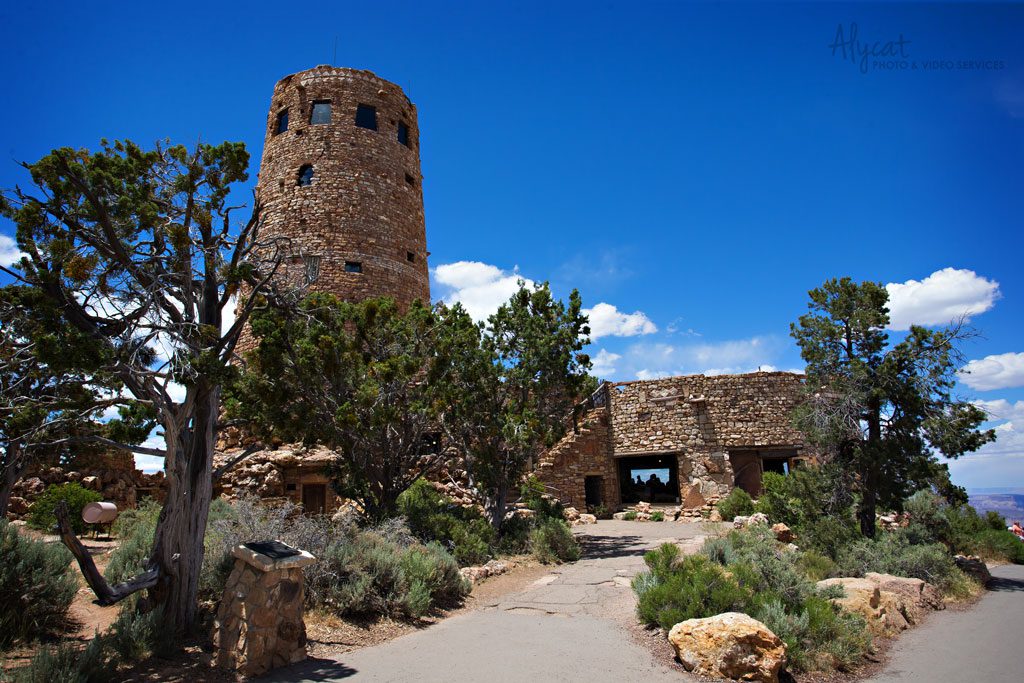
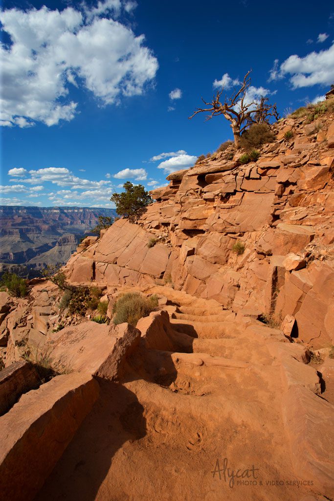
Most people prefer to enter Grand Canyon National Park through the southern entrance. It drops you right in the middle the Grand Canyon Village where most of the attractions are including the Rim Trail. There are also park and ride options in the town of Tusayan, which is right outside the park on Route 64. Wanting to get a feel for the park with less people, I decided to on the eastern entrance off of Route 89. It takes you through the Navajo Reservation and follows along the canyon. The first major place to stop once inside the park is Desert View Visitor Center, which could be one of my favorite places along the southern rim. It is one of the few places where you can see the river from the top.
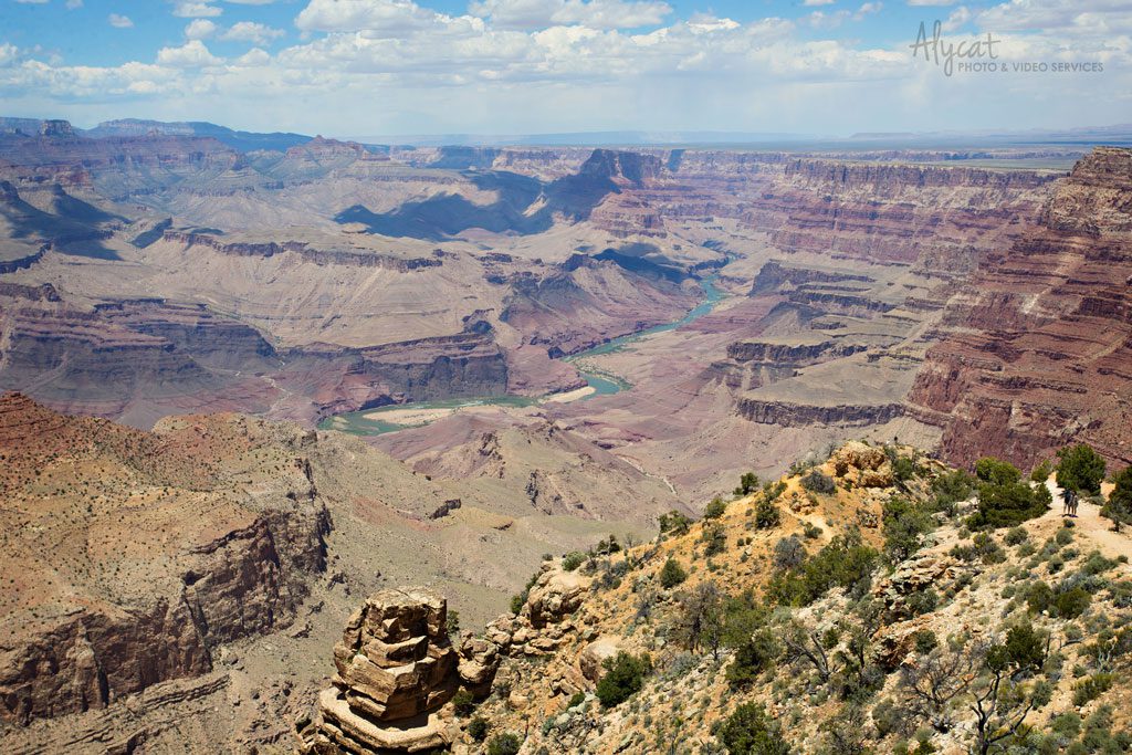
With fewer people around, you are guaranteed a good view.
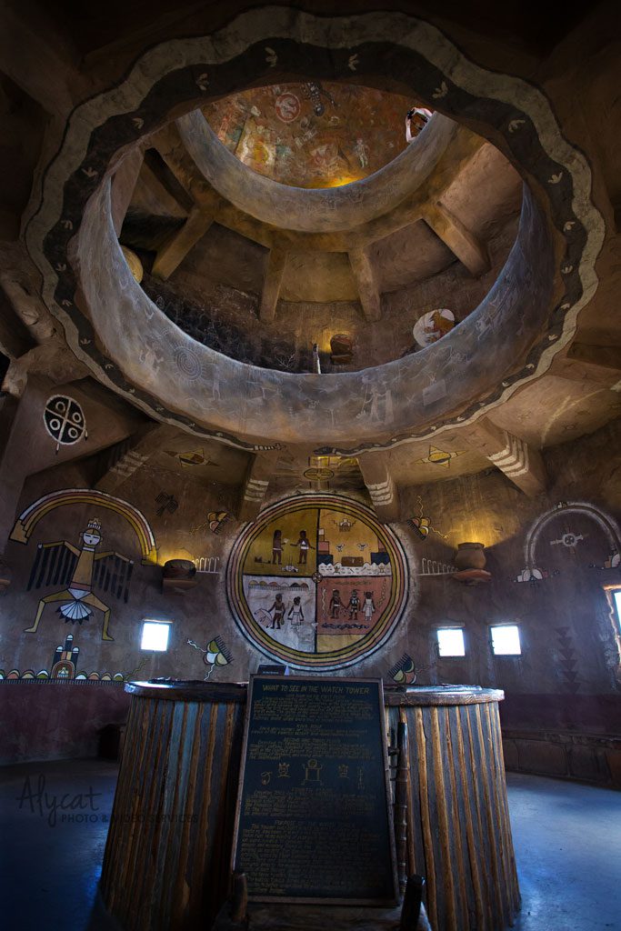
You can also explore the tower, which offers tons of information on the area’s rich history. Plus the views from the top just can’t be beat.
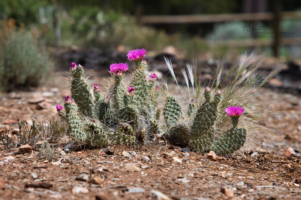
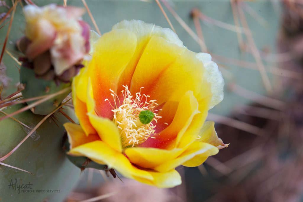
Some of the beautiful flora found in the park.
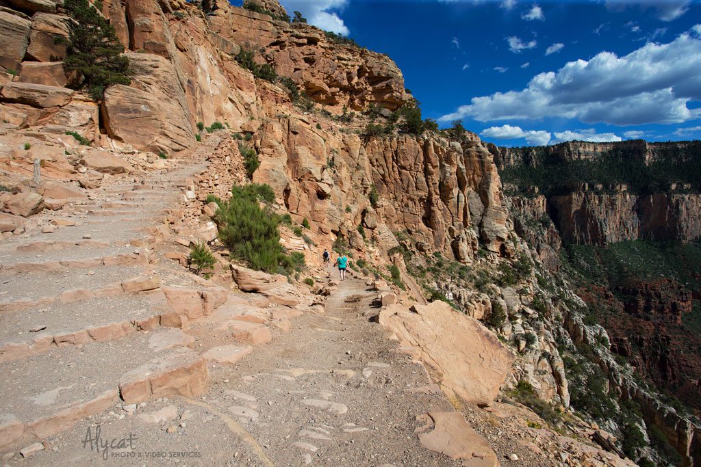
After talking with several rangers, I decided to tackle the South Kaibab Trail. Known for it’s striking wide open views of the canyon, the South Kaubab Trail is a steep step trail that leads all the way to the bottom of the canyon. Park rangers strongly recommend against trying to hike to the bottom and back up in one day. As a pretty fit person, I can tell you the hike is hard. I went about half way down before deciding to turn around. I felt like I could go forever. It was view after stunning view! However, what most people don’t realize is that it takes double the amount of time to get up as it is to go down. Plus you need to carry a ton of water and supplies. The farther down you go, the more water and supplies you need to take to get back up. So please, don’t try to hike down and back up in a day. Make plans to Rim to Rim hike instead!
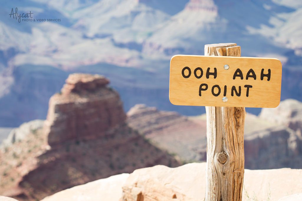
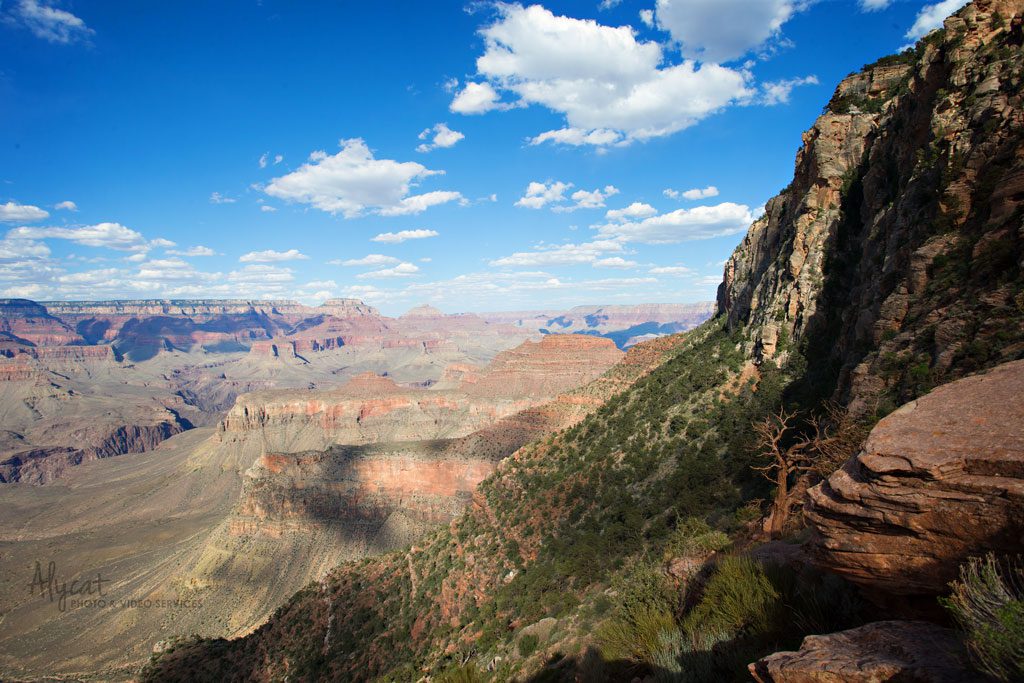
You really will say “Ooh Aah!”
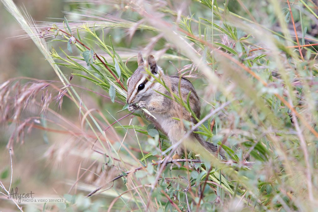
There is an abundance of wildlife as well. I sat watching this guy tear about some vegetation for a good 15 minutes.
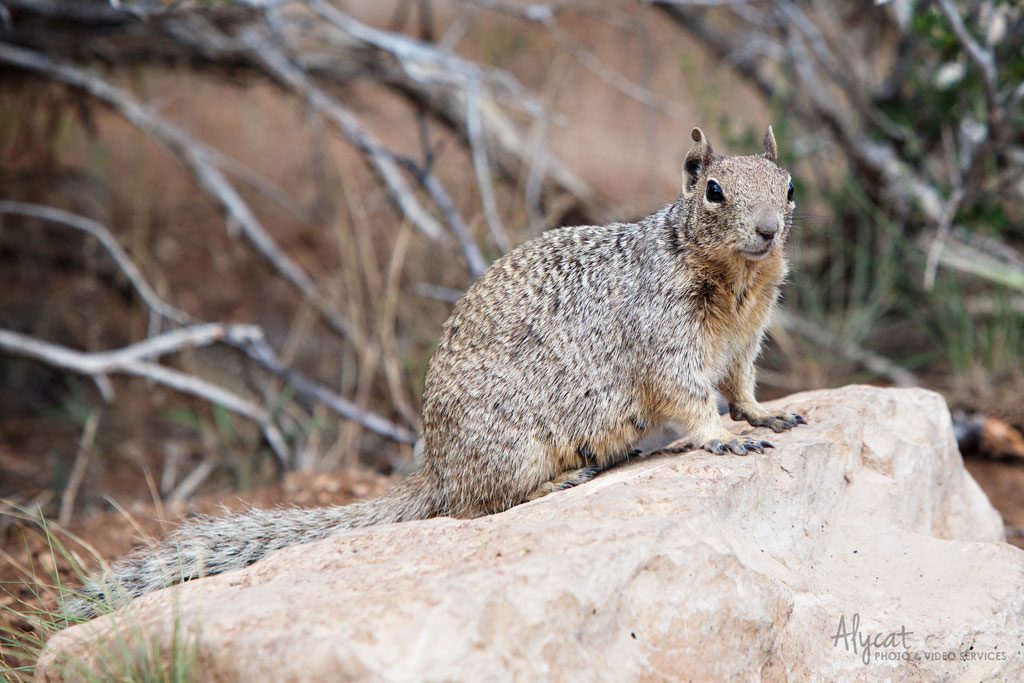
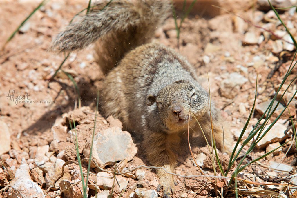
Squirrels, they are everywhere! They will run around you and roll and dig in the dirt. They will also steal your food. So keep your food close. I saw a poor child in tears as a squirrel ran off with half her sandwich.
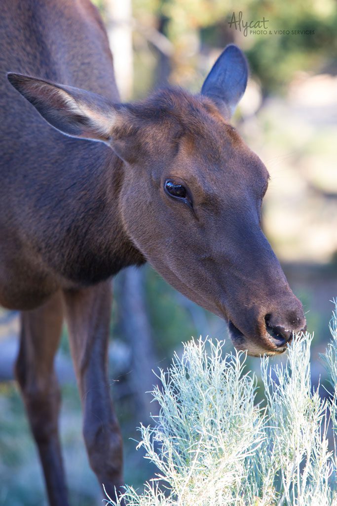
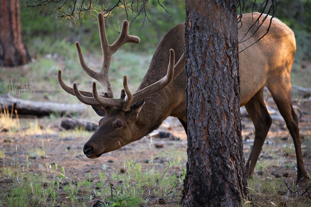
Then there are the majestic elk. Such beautiful creatures, but be sure to keep your distance. They are big and are not afraid to chase people down if they get too close.
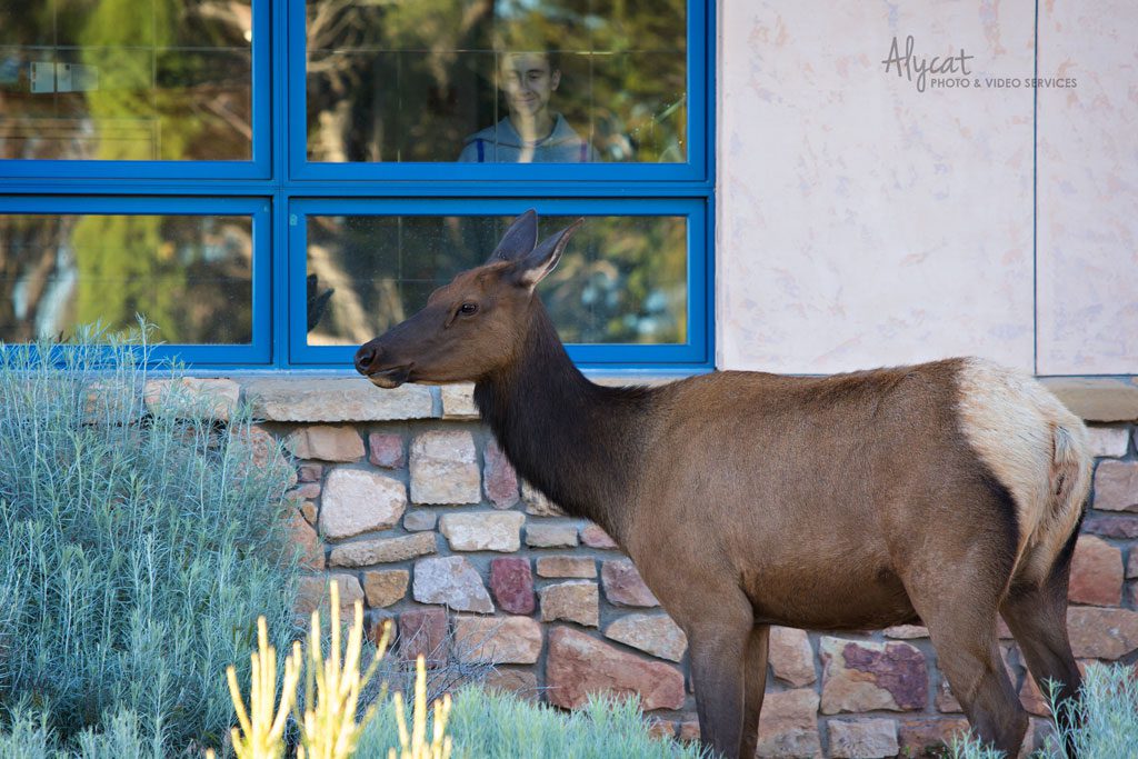
I love the kid in the window.
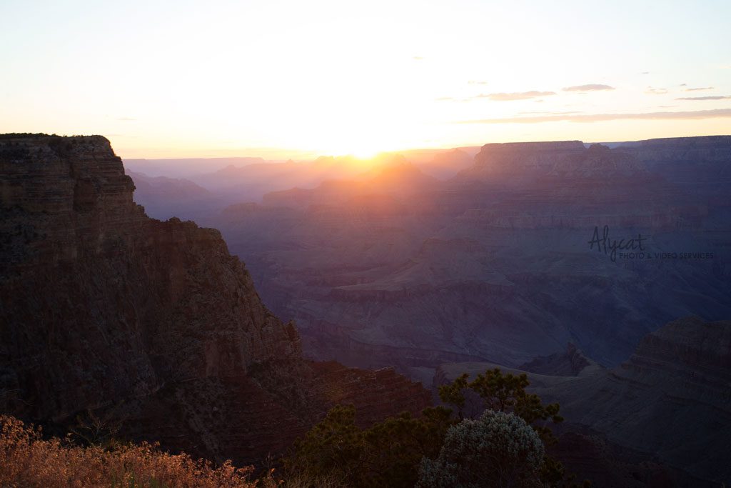
Sunset at the Grand Canyon is nothing short of breathtaking! After talking with several rangers and seeing two myself, I have decided that the best place in the canyon to watch sunset is at Lipan Point. Most folks cram into Hermits Nest at the other end of the village to see the sunset. Lipan Point offers gorgeous, wide open views of the sun setting over the canyon with very few people there to block your view. Sit back, relax and just take it all in. Lipan has a small parking lot. Since the buses don’t run that far down, you will need to drive to get there.
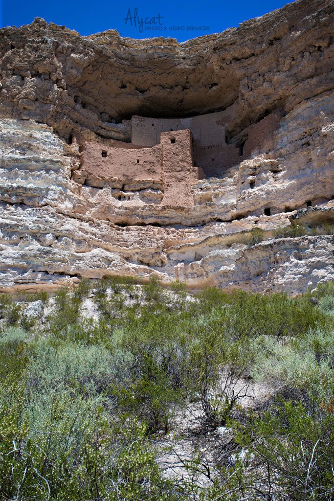
My last day was spent exploring Montezuma Castle, Montezuma Well and Tuzigoot National Monuments. The parks are about an hour (and about 5,000 feet in elevation) south of Flagstaff. The cool breezes were replaced with hot desert winds. The difference over such a short area was quite shocking.
I stood at the bottom of Montezuma Castle in complete awe. It blows my mind to think about the things people thousands of years ago were able to accomplish. It is truly a testament to what can be done when a group shares a goal and works together to accomplish it.
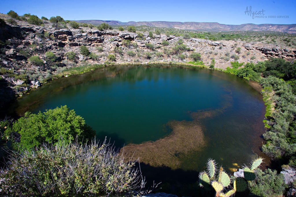
Monetzuma Well is literally an oasis in the middle of the desert. The area only receives an average of 13 inches of rain a year, making the well quite the oddity. It was discovered that the well is filled from the bottom by millions of gallons of water that has taken thousands of years to work its way back up to the surface.
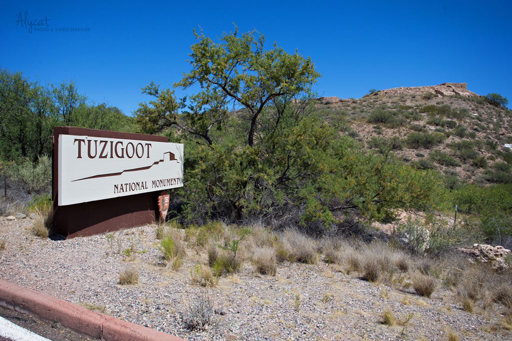
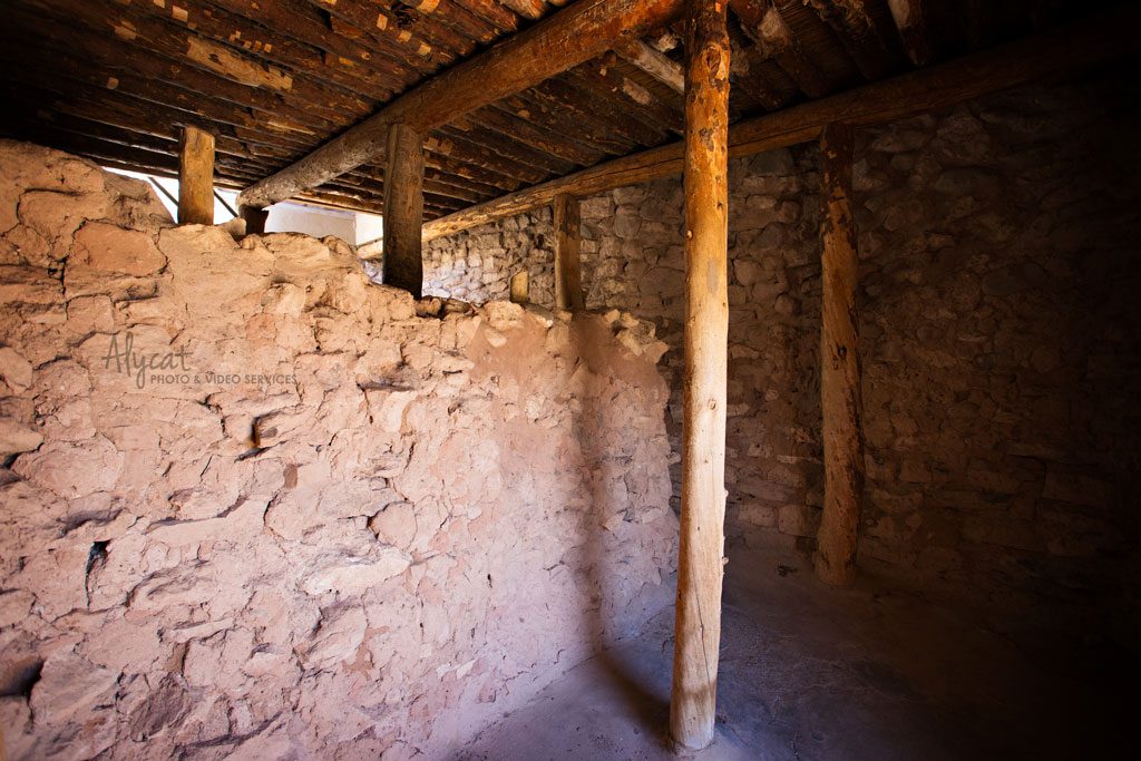
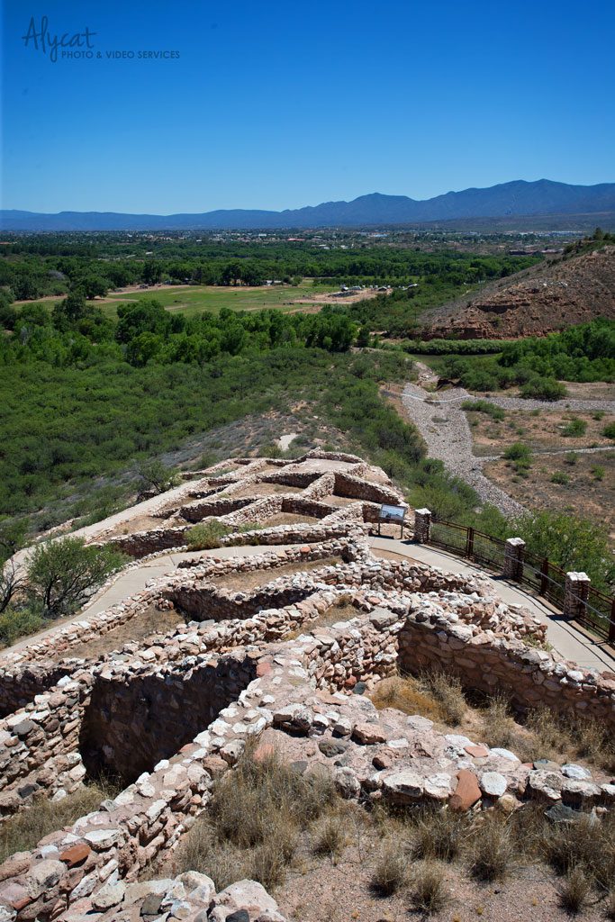
Tuzigoot National Monument is another group of pueblos built by the Sinagua people. What makes this park different from the others is that you can actually go inside one and climb to the top. The views are quite impressive.
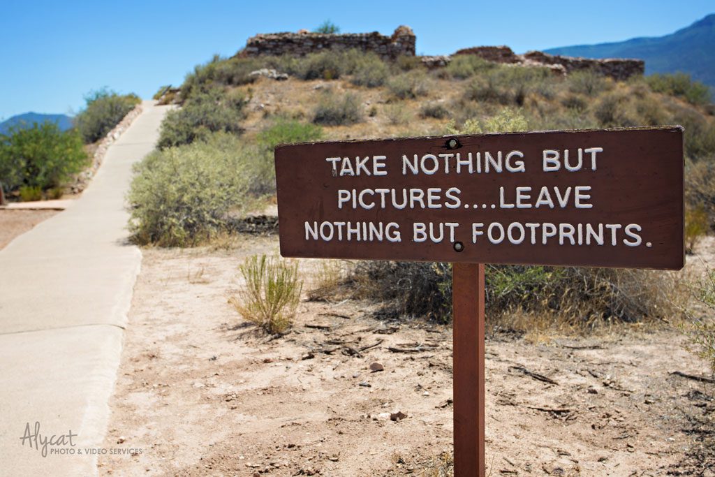
An important reminder!
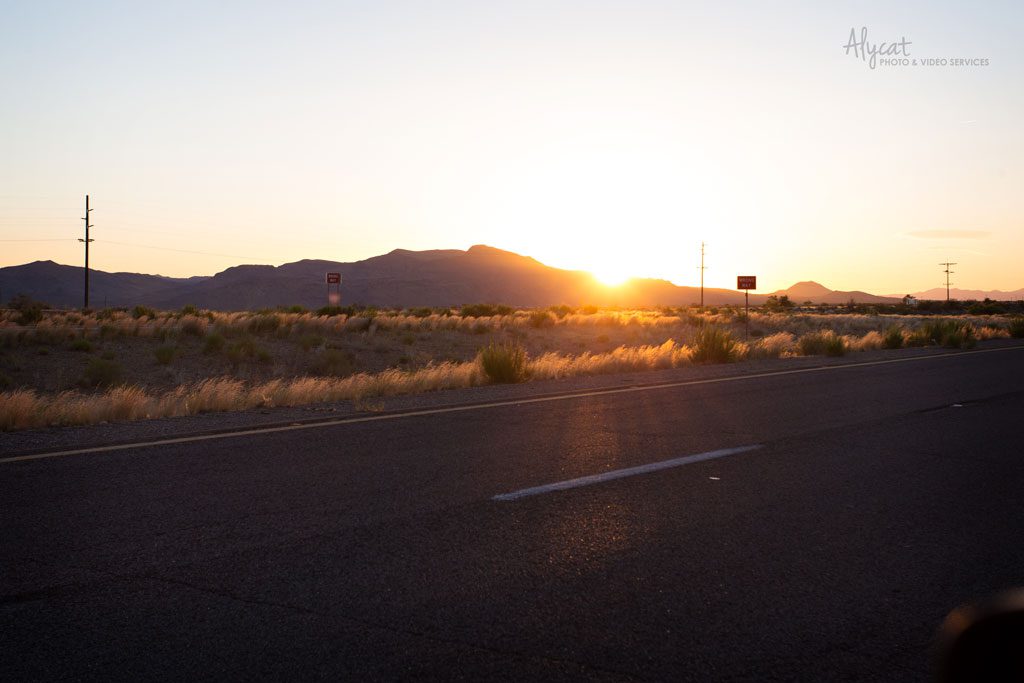
The sun sets on yet another Alycat Walkabout adventure. It was incredible! Arizona, you are lovely and I cannot wait to return and explore some more!